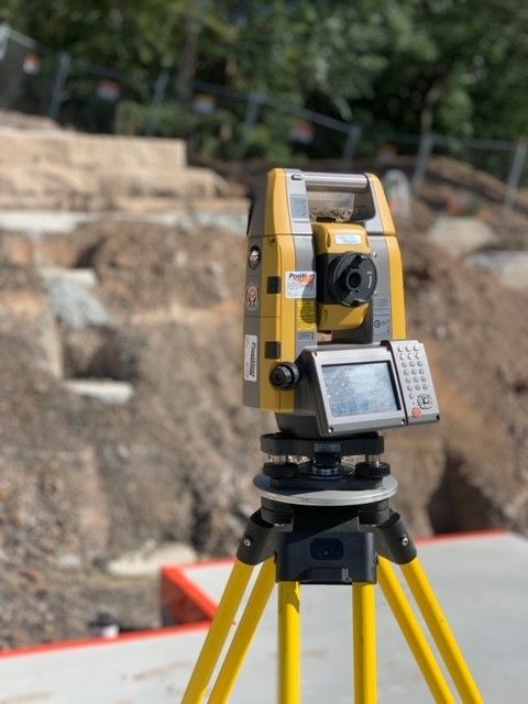
Experienced in SurveyingNastasi & Associates provides a comprehensive range of surveying services. Alongside our engineering services we've taken an integrated approach with an experienced surveying team, under the supervision of our Registered Surveyor, to streamline design, inspections and surveying to allow our customers building sites to carry on with construction from start to finish. The following residential surveys are currently provided in NSW and we’ve explained the differences between them and when they are required. Our surveying team can carry out other surveying services for land development, civil and construction.
Arrange a quote |  |
Detail SurveyWhen: Before a DA or CDC | A detail survey is most commonly used as an initial survey for the purposes of a development application (DA) also known as a Contour, feature or level survey. Typical situations where a detail survey is required are for a knockdown rebuild, granny flat, house extension, swimming pool, landscaping and garage addition. A detail survey is a plan that shows the features (structures, drains, trees, fences, utility services etc.) and levels across a property and any relevant adjoining property that maybe required. It will be used by builders, architects, designers or draftsman to design any future works. The survey must also be lodged as part of a DA or complying development to your local Government authority or private certifier. The amount of detail shown varies from job to job and is dependent on the information required by the Council for development application purposes, or your architect’s scope of work required. Notes: It is recommended a boundary definition survey be undertaken with all detail surveys as most Local Councils require it.
|
Boundary Definition SurveyWhen: Required by some councils in Sydney such as Northern Beaches Council, Sydney City Council, Inner West Council & Parramatta Council Who For: Architects, Draftsman & Council | A Boundary definition is where we find the underlying plans that relate to the definition of a property. These plans show information required to accurately position the boundary corners of a lot. This allows the surveyor to overlay these boundaries onto a detail survey or come back and mark the boundaries.
Notes: A boundary definition survey must be undertaken by or under the supervision of a Registered Surveyor as it relates to the legal definition of a parcel of land. Most properties can have a boundary definition undertaken on them. In cases where the underlying information is very old or limited, a plan of redefinition maybe required.
|
Boundary Marking SurveyWhen: Whenever or before construction Who For: House owners or Builders | A boundary marking is the process of physically marking out a boundary definition survey by marking the boundary corners onsite and providing a plan showing what has been marked. This allows you to see on the ground where the extent of your property is. It may be required for construction like retaining walls, as this allows the builder to build the wall in the correct location.
|
House Setout SurveyWhen: Whenever or before construction Who For: House owners or Builders | Once a construction certificate has been granted for a new house, house extension, granny flat, garage or swimming pool application, a house set out survey will be required to accurately mark out the proposed new works in relation to boundaries. This will need to be done as the Council or certifier will require a final occupation survey once construction has been completed. This will show the new structure in relation to the boundary. If this does not match, final approval cannot be granted.
|
Final Occupation SurveyWhen: After construction Who for: House owners, Builders & Certifiers | The final occupation survey (Final OC survey) is one requirement to gain your occupation certificate on the completion of new works. Councils potentially will not issue garbage bins, and banks may not release final payments until this has been completed. A sketch showing the completed works in relation to boundaries is supplied to ensure that it corresponds with the proposed design plans. Final Ident Report sketch
|
Work As Executed SurveyWhen: After construction Who for: House owners, Builders, Certifiers & Engineers | A Work-As-Executed (WAE) Survey is carried out at the completion of civil and hydraulics work. The importance of this survey is to confirm dimensions and reduced levels (RLs) of roads, driveways, stormwater systems, pits etc. compared to approved plans and designs.
|
Identification SurveyWhen: Before selling house Who for: House owners & Solicitors | An identification survey identifies existing buildings and improvements on a block of land, as well and any limitation from the title. It is recommended to have an ident survey done prior to purchasing a property, to protect against any potential disputes. It also gives the purchaser an understanding of any existence of easements, covenants and restrictions on the use of the land, and whether the subject land complies with the conditions. It also shows the distances of the walls, eaves and/or gutters from the boundaries of the property, or if there are any encroachments. A site plan and report are provided on the completion of this work.
|
PPN NumbersWhen: Before Subdividing Who for: House owners, Planners & Sydney Water | Pre-Allocated Plan Numbers (PPNs) are unique plan numbers issued to surveyors by NSW Land Registry Services (LRS) for a proposed land development. A PPN is requested by a surveyor and is allocated to a specific parcel of land before plans are ready for lodgement. PPNs do not have an automatic or early right to registration and are subject to the usual NSW LRS plan registration processes. They are also required in advance by Sydney Water of proposed subdivisions that require the provision of water utilities. |
